Watching the USGS streamflow graph gain and lose for a couple weeks raised our eyebrows. When the 10-day forecast revealed borderline weather, Liz and I looked at each other for reassurance. But with the local press bombarding us with
news of a mine potentially infiltrating Montana's Smith River drainage, we figured we better go while we had the permit, even if spring's unpredictability was in perfect form.
The highest high was forecast to be 51 degrees, the strongest gusts were predicted at 40 mph, and rain was projected three of our five days. And for the win, the prior week's warmth had set runoff in motion.
Just she and me for five cold, wet, wind-blown, isolated, glorious days on the Smith River.
The Smith River corridor is a 59-mile stretch of river bounded by towering cliffs and a boat ramp on each end. Montana Fish Wildlife and Parks manages the float section with cooperation from the US Forest Service and private land owners (80 percent of the float is on private land). Permits are required and given out via a lottery each March. Nine parties are allowed to launch per day, and boat campsites are assigned for each night when you check-in at Camp Baker (the put-in). It is typically done in four or five days. Prime dates are much harder to draw a permit for, which is why some parties (including ours) apply for April when you're almost guaranteed a permit. Almost guaranteed questionable weather and flows, too.
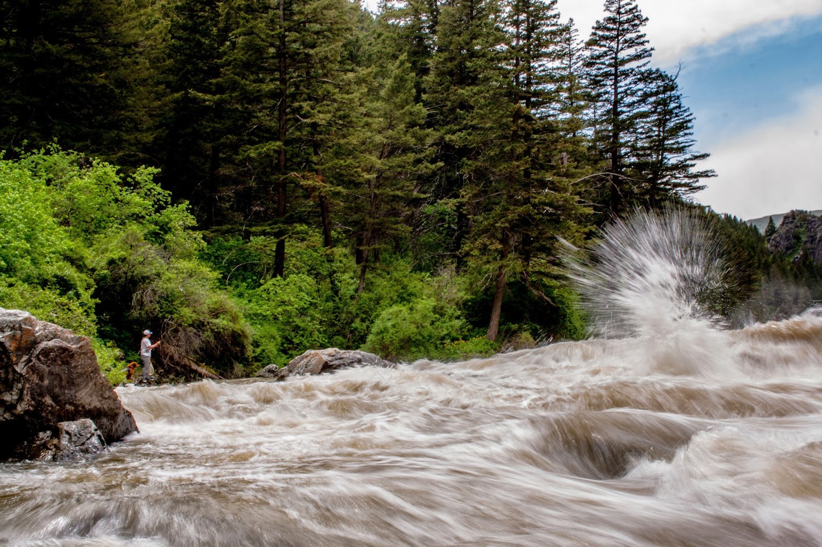
So we embarked... After the flow spiked to about 560 cfs early Wednesday morning (our launch day, April 23), we were pleased to see fishy green water at Camp Baker. But about 25 feet downstream enters Sheep Creek, which was vomiting mud. Our first two days were pretty blown out, and our fish had to come at tributary mouths.
Day three graced us with a lighter hue. Quickly, a 20-plus-incher was brought boatside before popping off, and later another dandy came to net. We'd had a day of fishing that seemed unlikely. Baetis backed-up in the foam eddies (fish eating them in places), midges were about, and we saw a few skwalas.
 |
| "Panic Attack" got lucky. |
Mid-canyon, the
Heaven on Earth Ranch offered an entertaining interlude. While Gary Anderson's grandson cut our firewood, the man himself carted us up to his beautiful saloon, showed us his massive bull elk mount, and poured us Deep Creek Specials while boasting of Chubby the black bear, who, prior to Montana Fish, Wildlife and Parks' crackdown, would take an apple right from his mouth. The Ranch refilled our water, ice and spirit. Floaters can book a cabin which includes steak dinner, cocktails, golf at the par-3 course on the river, showers, and more, and it won't count against your river nights. When we're rich...
We found three public-land pictograph locations. The first are handprints downstream of the mouth of Tenderfoot Creek at about river mile 16.2 on river left. You have to catch them while floating - they are above the water. The next are animals, handprints, and finger swipes on the cliff directly upstream of Crowsfoot boat camp on river left (you'll need to pull over and hike). The final is Pictograph Cave, which requires a short, steep, rocky hike to an opening that can be seen from the river. The trail is river left just downstream of lower Parker Flat - be on the lookout for the cave on the cliff side. This location has the most diversity and offers views of the river from above.
It's a mystical experience to feel connected to these ancient people, and the pictographs are considered sacred. If you locate them, make a point to tread lightly as the walls can be fragile.
 |
| Pictograph Cave. |
 |
| Crowsfoot pictographs. |
 |
| Handprints downstream of Tenderfoot. |
The wildlife was surprisingly humdrum. A few beavers and muskats, mule deer, a mink, one white-tailed deer, a mouse, one bald eagle, a few turkey vultures, many mergansers and mallards, and tons of Canada geese. There were also more houses and cabins than I anticipated.
The Seamstress (so called for the "needles threaded" through scattered river rocks) rowed about 75 percent of the trip, while I (nicknamed Panic Attack for overly aggressive oar strokes) was forced to fish...
Despite cold, wet nights, windy days, muddy campsites and barely translucent water, we agreed we'd do it again. Even in April.
As the sensation of bobbing downstream fades, sweet sadness enters. We survived and we're warm and dry, but the jagged walls, honking geese, and intimacy of a remote float have long-since faded. Our parting gifts are memories of Montana backcountry, the chance to grow together, and indulge in some of the best of the outdoors.
Related links: